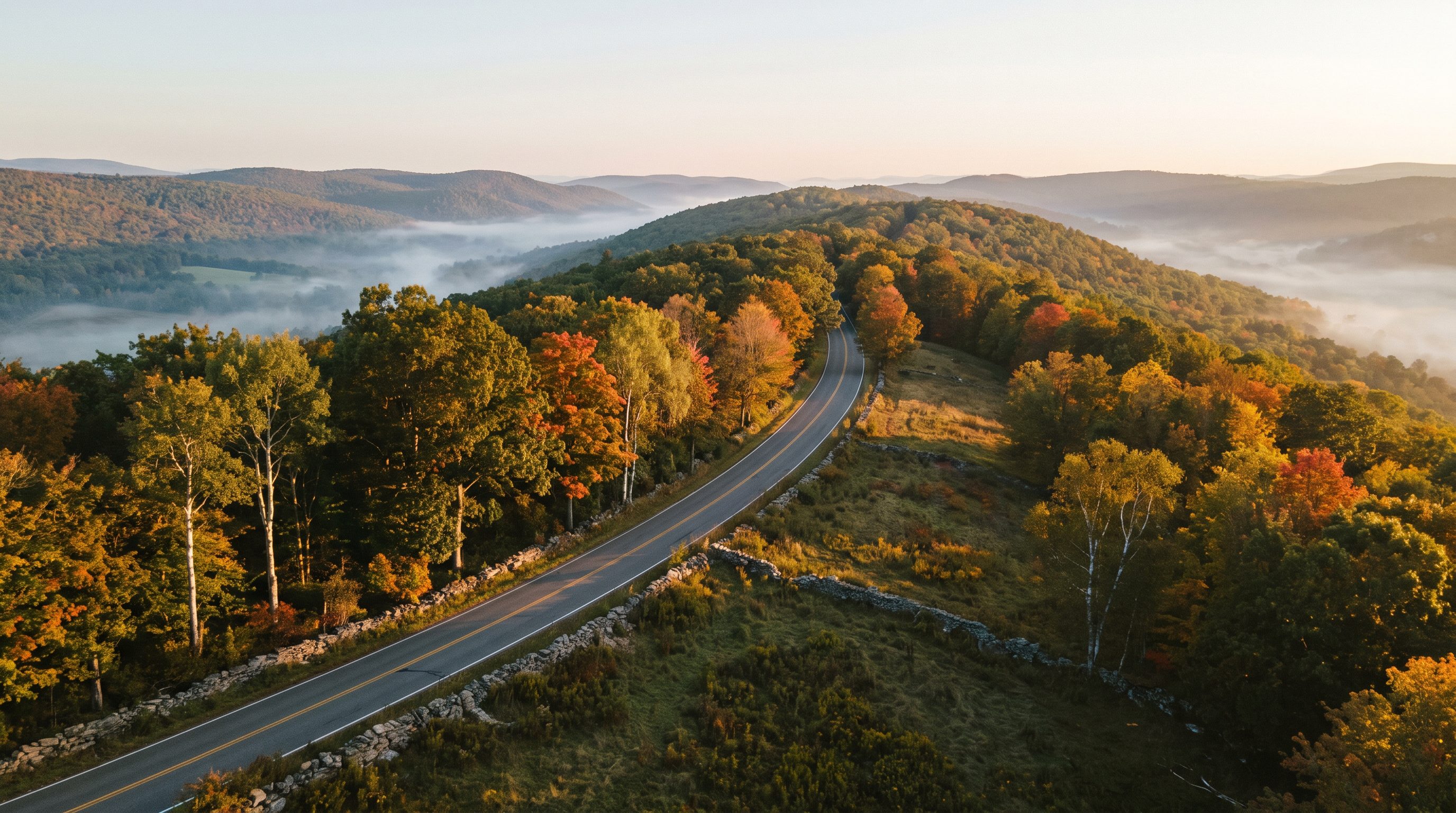
Mount Hope isn't a subdivision town.
Let's keep it that way.
Five small lots have been carved out of 13.06 acres in Orange County on Old Mountain Road — and the lot sizes don't appear to meet the Town's own zoning formula. Permits are issued and clearing has already started. This needs to happen before it's too late — here's what you can do now.
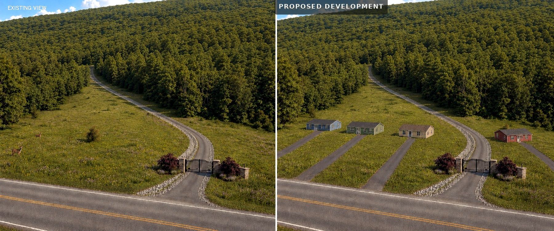
A ridge that's always been open space is being split into five house lots
In May 2026, a five-lot subdivision called "Sunset Ridge" was filed to carve 13.06 acres in Orange County at a property on Old Mountain Road (Tax Map Section 2, Block 1, Lot 1.22) into five lots. It was recorded with the Orange County Clerk on May 8, 2026 as Map #205-26.
Four of the five new building lots run from about 2.6 to 3.6 acres — noticeably smaller than most homesites in the surrounding RP-1 district, and dropped into a stretch of road that has always read as open, rural, and spread out.
Building permits for the project were filed the same day the current owner accepted an offer on the property. As of August 2026, permits are issued and tree clearing has already begun.
Acreage as shown on the filed plat, Map #205-26. Lot 4 is the existing homestead parcel and is not part of the 13.06 acres newly subdivided; the four new lots average roughly 3 acres.
This isn't about taste — it doesn't meet the Town's own zoning math
Mount Hope's code doesn't set a flat minimum lot size for the RP-1 (Resource Preservation) district. It uses a formula tied to elevation, slope, and other site factors. We ran that formula for this ridge.
Mount Hope Code Ch. 250, Art. V (Resource Preservation District bulk requirements). Working through the elevation/slope-based formula for this specific ridge site points to a minimum lot size in the 13–14 acre range — not the roughly 2–3.6 acres shown on the filed plans.
The filed plat's own zoning table lists a flat "2 acres" minimum for RP-1 — but that's not how the Resource Preservation district's minimum lot size actually works under the Town code. RP-1 uses a site-specific formula, not a flat acreage figure. There's no documentation anywhere on the filed plans showing that formula was ever calculated for this property.
This is the point worth leading with in any conversation with a town official, board member, or reporter — it doesn't require anyone to agree about aesthetics. It just requires reading the same code the Planning Board is supposed to enforce.
Even the developer's own paperwork raises red flags
This isn't only a question of permits and setbacks. It's about groundwater five families depend on, forest habitat that took decades to grow, the rural character of the road itself, and the value of the land many of us are counting on to pass on to our kids.
Two driveways fail the road's own sight-distance standard
The project's own submitted sight-distance analysis shows two of the five proposed driveways fall at or below the safe minimum distance for the posted 55 mph speed limit on Old Mountain Road — not a hypothetical future concern, but a problem the developer's own paperwork documents and doesn't resolve.
Retaining walls shown taller than their own design rating
Retaining walls on three of the lots are shown taller than the wall design specified in the plans — up to 5.5 feet against a 4-foot design detail. On a ridge with real grade, that's a structural safety question for future residents and anyone driving below.
A natural spring isn't shown on the plans at all
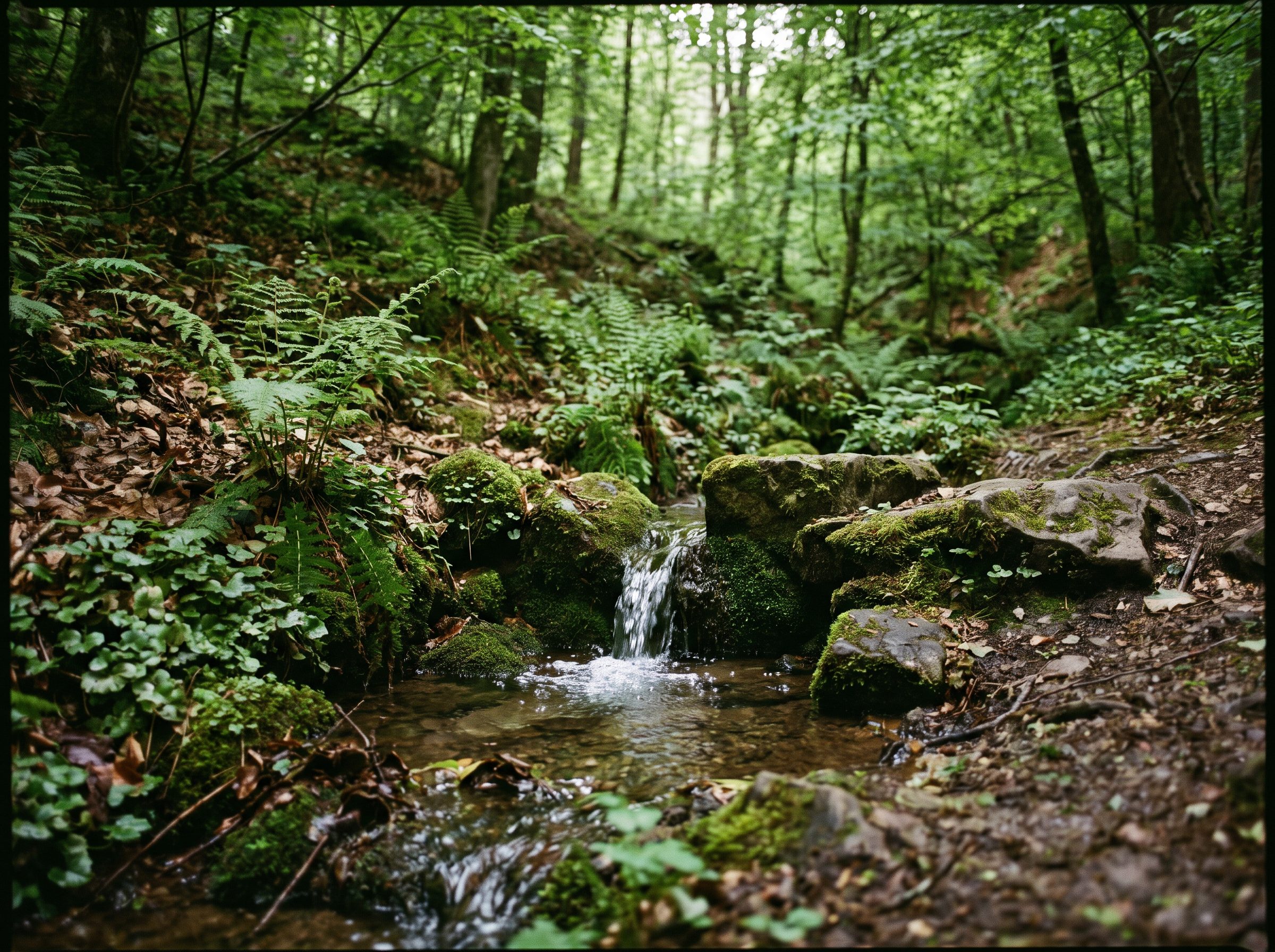
A spring begins on a neighboring property and flows toward this site — yet the filed plans have no symbol anywhere for streams, springs, or wetlands. If it isn't even marked, it raises a real question about whether it was accounted for in the drainage and construction plan.
Tree clearing is happening during bat breeding season
This ridge is forested habitat for two state-endangered bat species — the northern long-eared bat and the Indiana bat. State guidance recommends clearing trees between November and March, when these bats aren't roosting in the canopy, precisely to avoid harming them. Clearing is happening in August 2026 — during active roosting season.
No confirmed stormwater permit for 2.7 acres of disturbance
The project disturbs roughly 2.7 acres of soil, which triggers a mandatory state stormwater permit (SPDES GP-0-25-001). It's worth confirming publicly whether that permit and its runoff-control plan are actually in place before more of the hillside is cleared.
Five new wells, one shared aquifer
There's no municipal water system in this part of Mount Hope — every home relies on wells drawing from the same bedrock aquifer. Five new wells serving new houses on a ridge is a legitimate shared concern for every well owner nearby, not just adjoining lots.
A quiet ridge road, subdivided one project at a time
Old Mountain Road has stayed a wooded, low-density country road for decades — wide setbacks, big lots, no curbs or streetlights. Five new houses and driveways packed onto one hillside is the first project of its kind here, and it sets a precedent: once one parcel subdivides this way, it's easier for the next one to follow, and harder to keep the road looking and feeling the way it does today.
Rural character carries real value — and it isn't automatically replaceable
Research on rural and large-lot property markets shows that open space and intact rural character carry a measurable price premium for neighboring homes (Canadian Journal of Agricultural Economics; American Journal of Agricultural Economics). That's exactly the kind of value many families on Old Mountain Road are counting on — as a nest egg, and as something to pass on to their kids. Once a hillside like this is cleared and subdivided, that particular kind of value doesn't come back.
An open question for the Town
New homes add some tax revenue, but they also add cost — school enrollment, road wear, emergency services, and, if the drainage or septic concerns above are real, cleanup costs that can fall back on the Town or neighboring property owners.
Has anyone actually calculated whether this development is a net gain or a net cost to the Town once infrastructure, safety review, and environmental costs are included? We haven't seen that analysis publicly — and we think the Town should require one before approval stands.
Beyond the ledger, there's a harder-to-measure cost: groundwater, forest, and the rural feel of the road all change once a hillside like this is cleared and subdivided — and none of that comes back once it's gone.
The filed map, straight from the county clerk's office
This is the actual boundary survey filed with the Orange County Clerk on May 8, 2026. Judge the lot sizes for yourself — no summary, no spin.
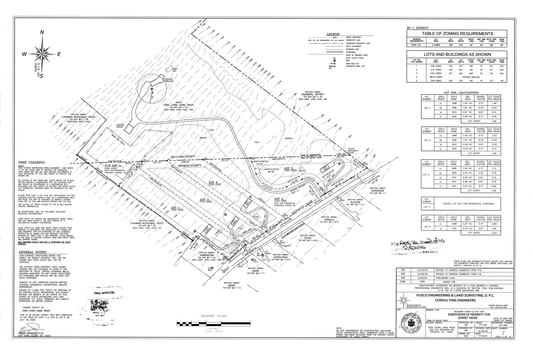
Subdivision of Property for Sunset Ridge — filed with the Orange County Clerk, Map #205-26, recorded May 8, 2026.
Download Full Plat (PDF)If the Town won't look closely, these offices can
Two review questions are worth raising above the Town level: whether this plat was ever referred to Orange County Planning given its location on a county and municipal border, and whether anyone actually assessed the state-endangered bat species on this ridge before clearing began — a separate track from the stormwater permit. Here's exactly who to ask.
Orange County Dept. of Planning
Ask whether this plat was referred under GML §239-n, given the parcel's location on the Orange/Sullivan county line.
Phone 845-615-3840
Email planning@orangecountygov.com
124 Main St, Goshen, NY 10924
Orange County Dept. of Health — Environmental Health
Ask about well and septic siting review for lots sharing the same bedrock aquifer.
Phone 845-291-2331
124 Main St, Goshen, NY 10924
Orange County Legislature — District 18
Janet Sutherland represents the Town of Mount Hope on the County Legislature.
Phone 845-500-2115
Orange County Legislature — District 13
Thomas Faggione also represents part of the Town of Mount Hope on the County Legislature.
Phone 845-551-5784
NYSDEC Region 3 — Environmental Permits
Ask specifically about the endangered-species review for the northern long-eared and Indiana bat — separate from the stormwater permit.
Phone 845-256-3054
Email dep.r3@dec.ny.gov
21 South Putt Corners Rd, New Paltz, NY 12561
U.S. Fish & Wildlife Service — NY Ecological Services
Handles federal Endangered Species Act consultation for projects affecting listed bat species.
Phone 607-753-9334
Email fw5es_nyfo@fws.gov
3817 Luker Rd, Cortland, NY 13045
NYS Assembly — District 98
Karl Brabenec represents the Town of Mount Hope in the State Assembly.
Phone 845-544-7551
Email brabeneck@nyassembly.gov
NYS Senate — District 42
James Skoufis represents the Town of Mount Hope in the State Senate.
Phone 845-567-1270
These are public offices, not part of Protect Mount Hope. We have no relationship with any of them — we're listing them because they each have a specific, legitimate role in reviewing a project like this one.
Here's what you can do now
Clearing is already underway on the ridge — every week that passes makes this harder to reverse. Each option below opens your email app with a message already written — just review it, add your name, and hit send before it's too late. Nothing is posted or shared automatically.
Add your name
This petition asks the Town of Mount Hope to pause construction and protect what these five lots put at risk: the shared bedrock aquifer every well on this road draws from, the spring and wetland that appear nowhere on the filed plans, and the forested slope that's part of the Shawangunk Ridge running through this stretch of Mount Hope.
We'll open your email app with your signature pre-written to send to the organizers. Nothing is submitted until you hit send in your own inbox.
Tell the Town directly
Pick which officials should hear from you, edit the message if you'd like, then send it from your own email.
Picking one swaps in a ready-to-send message below — feel free to edit it before sending.
This opens your email app with all selected officials already in the "To" field. You control exactly what's sent before it goes anywhere.
Stay in the loop
Get a heads-up before the next Planning Board or Town Board meeting where this project is on the agenda.
A few things people ask
Who's behind this campaign?
Protect Mount Hope is an independent group of Mount Hope neighbors. We are not affiliated with the Town of Mount Hope, Orange County, or any political party or candidate.
Isn't this just about one property owner?
This is about whether the Town's own zoning code was applied correctly — a question that matters to every RP-1 property in Mount Hope, not just this one. If the density formula wasn't calculated here, the same could happen on the next ridge over.
What exactly do you want the Town to do?
Pause construction, formally verify the lot-size calculations against the Town's own RP-1 formula, and require the missing environmental and safety documentation — sight distance, wetland/spring delineation, retaining wall design, and stormwater permitting — before this project proceeds any further.
Is this against new housing in general?
No. This is about one specific project appearing not to meet the Town's own site-specific formula for this district. Development that follows the code is a different conversation.